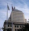
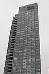
Grattacieli più alti di Boston
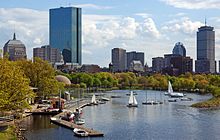

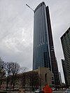
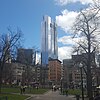
Boston, la capitale dello stato americano del Massachusetts e la più grande città della Nuova Inghilterra, ospita 251 grattacieli completati,[1] 32 dei quali più alti di 122 metri. La maggior parte dei grattacieli della città sono raggruppati nei quartieri di Financial District e di Back Bay. L'edificio più alto di Boston è la 200 Clarendon di 60 piani, meglio conosciuta dai locali come la John Hancock Tower, che si erge per 241 metri nel distretto di Back Bay.[2] È anche l'edificio più alto della Nuova Inghilterra e il 63° edificio più alto degli Stati Uniti. Il secondo edificio più alto di Boston è la Prudential Tower, che si erge su 52 piani per un'altezza di 228 metri.[3] Al tempo delcompletamento della Prudential Tower nel 1964, era l'edificio più alto del Nord America al di guori della città di New York.[4]
Edifici più alti[modifica | modifica wikitesto]
Cronologia degli edifici più alti[modifica | modifica wikitesto]
| Nome | Immagine | indirizzo | Anni più alti | Altezza (in metri) |
Piani | Coordinate | Note |
|---|---|---|---|---|---|---|---|
| Old State House | 
|
206 Washington Street | 1713 – 1745 | 20 | 3 | 42°21′31.57″N 71°03′28.1″W / 42.358769°N 71.057806°W | [89] |
| Vecchia chiesa del nord | 
|
193 Salem Street | 1745 – 1810 | 53 | 1 | 42°21′58.78″N 71°03′16.04″W / 42.366328°N 71.054456°W | [90] |
| Park Street Church | 
|
1 Park Street | 1810 – 1867 | 66 | 1 | 42°21′24.88″N 71°03′43.74″W / 42.356911°N 71.062151°W | [91] |
| Chiesa dell'Alleanza | 
|
67 Newbury Street | 1867 – 1915 | 72 | 1 | 42°21′07″N 71°04′26″W / 42.351944°N 71.073889°W | [92] |
| Custom House Tower | 
|
3 McKinley Square | 1915 – 1964 | 151 | 32 | 42°21′32.65″N 71°03′12.13″W / 42.359069°N 71.053369°W | [55] |
| Prudential Tower | 
|
800 Boylston Street | 1964 – 1976 | 228 | 52 | 42°20′49.78″N 71°04′57.08″W / 42.347161°N 71.082522°W | [3] |
| Hancock Place | 
|
200 Clarendon Street | 1976 – presente | 241 | 60 | 42°20′57.4″N 71°04′29.2″W / 42.349278°N 71.074778°W | [6] |
Note[modifica | modifica wikitesto]
- ^ emporis.com, https://web.archive.org/web/20130203225501/http://www.emporis.com/city/boston-ma-usa. URL consultato il 18 febbraio 2013 (archiviato dall'url originale il 3 febbraio 2013).
- ^ a b emporis.com, https://web.archive.org/web/20080315083902/http://www.emporis.com/en/wm/bu/?id=johnhancocktower-boston-ma-usa. URL consultato il 17 agosto 2012 (archiviato dall'url originale il 15 marzo 2008).
- ^ a b c Prudential Tower, su skyscraperpage.com. URL consultato il 20 agosto 2012 (archiviato dall'url originale il 24 febbraio 2012).
- ^ a b emporis.com, https://web.archive.org/web/20070930041001/http://www.emporis.com/en/wm/bu/?id=prudentialtower-boston-ma-usa. URL consultato il 20 agosto 2012 (archiviato dall'url originale il 30 settembre 2007).
- ^ Tim Logan, So, what should we call the John Hancock Tower now?, su bostonglobe.com, Boston Globe. URL consultato il 1º agosto 2015 (archiviato il 1º agosto 2015).
- ^ a b John Hancock Tower, su skyscraperpage.com. URL consultato il 20 agosto 2012 (archiviato l'8 agosto 2012).
- ^ John Hancock Tower, su en.structurae.de, Structurae.de. URL consultato il 20 agosto 2012.
- ^ Prudential Tower, su en.structurae.de, Structurae.de. URL consultato il 20 agosto 2012.
- ^ Four Seasons Hotel and Private Residences One Dalton Street, su pcf-p.com, Pei Cobb Freed & Partners. URL consultato il 17 dicembre 2016 (archiviato il 13 luglio 2016).
- ^ Archived copy, su skyscrapercenter.com. URL consultato il 28 febbraio 2017 (archiviato il 1º marzo 2017).
- ^ Federal Reserve Bank Building, su emporis.com. URL consultato il 20 agosto 2012 (archiviato il 29 settembre 2007).
- ^ Federal Reserve Bank, su skyscraperpage.com. URL consultato il 20 agosto 2012 (archiviato il 7 agosto 2012).
- ^ Federal Reserve Bank of Boston, su en.structurae.de, Structurae.de. URL consultato il 20 agosto 2012.
- ^ One Boston Place, su skyscraperpage.com. URL consultato il 20 agosto 2012 (archiviato l'8 agosto 2012).
- ^ One Boston Place, su emporis.com. URL consultato il 20 agosto 2012 (archiviato il 30 settembre 2007).
- ^ One Boston Place, su en.structurae.de, Structurae.de. URL consultato il 20 agosto 2012.
- ^ One International Place, su emporis.com. URL consultato il 20 agosto 2012 (archiviato il 30 settembre 2007).
- ^ One International Place, su skyscraperpage.com. URL consultato il 20 agosto 2012 (archiviato l'8 agosto 2012).
- ^ One International Place, su en.structurae.de, Structurae.de. URL consultato il 20 agosto 2012.
- ^ First National Bank, su skyscraperpage.com. URL consultato il 20 agosto 2012 (archiviato l'8 agosto 2012).
- ^ 100 Federal Street, su emporis.com. URL consultato il 20 agosto 2012 (archiviato il 30 settembre 2007).
- ^ First National Bank of Boston, su en.structurae.de, Structurae.de. URL consultato il 20 agosto 2012.
- ^ 1 Financial Center, su skyscraperpage.com. URL consultato il 20 agosto 2012 (archiviato l'8 agosto 2012).
- ^ One Financial Center, su emporis.com. URL consultato il 20 agosto 2012 (archiviato il 30 settembre 2007).
- ^ One Financial Center, su en.structurae.de, Structurae.de. URL consultato il 20 agosto 2012.
- ^ 111 Huntington Avenue, su skyscraperpage.com. URL consultato il 20 agosto 2012 (archiviato il 7 agosto 2012).
- ^ 111 Huntington Avenue, su emporis.com. URL consultato il 20 agosto 2012 (archiviato il 26 febbraio 2008).
- ^ 111 Huntington Avenue, su en.structurae.de, Structurae.de. URL consultato il 20 agosto 2012.
- ^ Two International Place, su skyscraperpage.com. URL consultato il 20 agosto 2012 (archiviato il 7 agosto 2012).
- ^ Two International Place, su emporis.com. URL consultato il 20 agosto 2012 (archiviato il 30 settembre 2007).
- ^ Two International Place, su en.structurae.de, Structurae.de. URL consultato il 20 agosto 2012.
- ^ One Post Office Square, su skyscraperpage.com. URL consultato il 20 agosto 2012 (archiviato il 12 agosto 2012).
- ^ One Post Office Square, su emporis.com. URL consultato il 20 agosto 2012 (archiviato il 29 settembre 2007).
- ^ One Post Office Square, su en.structurae.de, Structurae.de. URL consultato il 20 agosto 2012.
- ^ One Federal Street, su skyscraperpage.com. URL consultato il 20 agosto 2012 (archiviato il 7 agosto 2012).
- ^ One Federal Street, su emporis.com. URL consultato il 20 agosto 2012 (archiviato il 29 settembre 2007).
- ^ One Federal Street, su en.structurae.de, Structurae.de. URL consultato il 20 agosto 2012.
- ^ Exchange Place, su skyscraperpage.com. URL consultato il 20 agosto 2012 (archiviato l'8 agosto 2012).
- ^ Exchange Place, su emporis.com. URL consultato il 20 agosto 2012 (archiviato il 26 febbraio 2008).
- ^ Exchange Place, su en.structurae.de, Structurae.de. URL consultato il 20 agosto 2012.
- ^ 60 State Street, su skyscraperpage.com. URL consultato il 20 agosto 2012 (archiviato l'8 agosto 2012).
- ^ 60 State Street, su emporis.com. URL consultato il 20 agosto 2012 (archiviato il 1º marzo 2008).
- ^ One Beacon Street, su skyscraperpage.com. URL consultato il 20 agosto 2012 (archiviato l'8 agosto 2012).
- ^ One Beacon Street, su emporis.com. URL consultato il 20 agosto 2012 (archiviato il 16 marzo 2008).
- ^ One Beacon Street, su en.structurae.de, Structurae.de. URL consultato il 20 agosto 2012.
- ^ 1 Lincoln Street, su skyscraperpage.com. URL consultato il 20 agosto 2012 (archiviato l'8 agosto 2012).
- ^ State Street Financial Center, su emporis.com. URL consultato il 20 agosto 2012 (archiviato il 30 settembre 2007).
- ^ State Street Financial Center, su en.structurae.de, Structurae.de. URL consultato il 20 agosto 2012.
- ^ 28 State Street, su skyscraperpage.com. URL consultato il 20 agosto 2012 (archiviato l'8 agosto 2012).
- ^ 28 State Street, su emporis.com. URL consultato il 20 agosto 2012 (archiviato il 25 febbraio 2008).
- ^ 28 State Street, su en.structurae.de, Structurae.de. URL consultato il 20 agosto 2012.
- ^ Archived copy, su bostonredevelopmentauthority.org. URL consultato il 26 novembre 2015 (archiviato il 26 novembre 2015).
- ^ David Scharfenberg, Developers Propose New Gateway To TD Garden, su wbur.org. URL consultato il 15 giugno 2013 (archiviato il 22 settembre 2014).
- ^ Casey Ross, Two towers proposed at TD Garden, su bostonglobe.com, boston.com. URL consultato il 15 giugno 2013 (archiviato l'11 giugno 2013).
- ^ a b Custom House Tower, su skyscraperpage.com. URL consultato il 20 agosto 2012 (archiviato il 7 agosto 2012).
- ^ Marriott's Custom House, su emporis.com. URL consultato il 20 agosto 2012 (archiviato il 29 settembre 2007).
- ^ Custom House, su en.structurae.de, Structurae.de. URL consultato il 20 agosto 2012.
- ^ John Hancock Building, su skyscraperpage.com. URL consultato il 20 agosto 2012 (archiviato l'8 agosto 2012).
- ^ John Hancock Building, su emporis.com. URL consultato il 20 agosto 2012 (archiviato il 30 settembre 2007).
- ^ Hancock Building, su en.structurae.de, Structurae.de. URL consultato il 20 agosto 2012.
- ^ 33 Arch Street, su skyscraperpage.com. URL consultato il 20 agosto 2012 (archiviato il 7 agosto 2012).
- ^ 33 Arch Street, su emporis.com. URL consultato il 20 agosto 2012 (archiviato il 29 settembre 2007).
- ^ 33 Arch Street, su en.structurae.de, Structurae.de. URL consultato il 20 agosto 2012.
- ^ State Street Bank, su skyscraperpage.com. URL consultato il 20 agosto 2012 (archiviato l'8 agosto 2012).
- ^ 225 Franklin Street, su emporis.com. URL consultato il 20 agosto 2012 (archiviato il 30 settembre 2007).
- ^ State Street Bank Building, su en.structurae.de, Structurae.de. URL consultato il 20 agosto 2012.
- ^ Ritz-Carlton Towers Boston Common - Tower I, su skyscraperpage.com. URL consultato il 20 agosto 2012 (archiviato l'8 agosto 2012).
- ^ Ritz-Carlton Boston Common Tower 1, su emporis.com. URL consultato il 20 agosto 2012 (archiviato il 30 settembre 2007).
- ^ Ritz-Carlton Boston Common - Tower I, su en.structurae.de, Structurae.de. URL consultato il 20 agosto 2012.
- ^ 125 High Street, su skyscraperpage.com. URL consultato il 20 agosto 2012 (archiviato il 12 agosto 2012).
- ^ 125 High Street, su emporis.com. URL consultato il 20 agosto 2012 (archiviato il 30 settembre 2007).
- ^ 125 High Street, su en.structurae.de, Structurae.de. URL consultato il 20 agosto 2012.
- ^ 100 Summer Street, su skyscraperpage.com. URL consultato il 20 agosto 2012 (archiviato il 7 agosto 2012).
- ^ 100 Summer Street, su emporis.com. URL consultato il 20 agosto 2012 (archiviato il 30 settembre 2007).
- ^ 100 Summer Street, su en.structurae.de, Structurae.de. URL consultato il 20 agosto 2012.
- ^ Obstruction Evaluation / Airport Airspace Analysis (OE/AAA), su oeaaa.faa.gov. URL consultato il 28 marzo 2016 (archiviato il 1º ottobre 2015).
- ^ Ritz-Carlton Towers Boston Common - Tower II, su skyscraperpage.com. URL consultato il 20 agosto 2012 (archiviato l'8 agosto 2012).
- ^ Ritz-Carlton Towers Boston Common - Tower II, su emporis.com. URL consultato il 20 agosto 2012 (archiviato il 30 settembre 2007).
- ^ Ritz-Carlton Towers Boston Common - Tower II, su en.structurae.de, Structurae.de. URL consultato il 20 agosto 2012.
- ^ McCormack Building, su skyscraperpage.com. URL consultato il 20 agosto 2012 (archiviato l'8 agosto 2012).
- ^ McCormack Building, su emporis.com. URL consultato il 20 agosto 2012 (archiviato il 30 settembre 2007).
- ^ McCormack Building, su en.structurae.de, Structurae.de. URL consultato il 20 agosto 2012.
- ^ Keystone Building, su emporis.com. URL consultato il 20 agosto 2012 (archiviato il 29 settembre 2007).
- ^ Keystone Building, su skyscraperpage.com. URL consultato il 20 agosto 2012 (archiviato l'8 agosto 2012).
- ^ Keystone Building, su en.structurae.de, Structurae.de. URL consultato il 20 agosto 2012.
- ^ Harbor Towers I, su skyscraperpage.com. URL consultato il 20 agosto 2012 (archiviato l'8 agosto 2012).
- ^ Harbor Towers I, su emporis.com. URL consultato il 20 agosto 2012 (archiviato il 30 settembre 2007).
- ^ Harbor Towers I, su en.structurae.de, Structurae.de. URL consultato il 20 agosto 2012.
- ^ emporis.com, http://www.emporis.com/building/oldstatehouse-boston-ma-usa771. URL consultato il 19 agosto 2012.
- ^ skyscraperpage.com, https://web.archive.org/web/20120309161233/http://skyscraperpage.com/cities/?buildingID=22260. URL consultato il 20 agosto 2012 (archiviato dall'url originale il 9 marzo 2012).
- ^ skyscraperpage.com, https://web.archive.org/web/20120309161243/http://skyscraperpage.com/cities/?buildingID=22393. URL consultato il 20 agosto 2012 (archiviato dall'url originale il 9 marzo 2012).
- ^ skyscraperpage.com, https://web.archive.org/web/20120309161248/http://skyscraperpage.com/cities/?buildingID=22265. URL consultato il 20 agosto 2012 (archiviato dall'url originale il 9 marzo 2012).
Voci correlate[modifica | modifica wikitesto]
Altri progetti[modifica | modifica wikitesto]
 Wikimedia Commons contiene immagini o altri file su grattacieli più alti di Boston
Collegamenti esterni[modifica | modifica wikitesto]
Mappa di tutte le coordinate: OpenStreetMap · Bing (max 200) - Esporta: KML · GeoRSS · microformat · RDF


