File:Floods Recede around the Wabash-Ohio Confluence.jpg
Vai alla navigazione
Vai alla ricerca
Dimensioni di questa anteprima: 466 × 600 pixel. Altre risoluzioni: 186 × 240 pixel | 373 × 480 pixel | 596 × 768 pixel | 795 × 1 024 pixel | 1 591 × 2 048 pixel | 2 968 × 3 821 pixel.
File originale (2 968 × 3 821 pixel, dimensione del file: 3,38 MB, tipo MIME: image/jpeg)
| Questo file e la sua pagina di descrizione (discussione · modifica) si trovano su Wikimedia Commons (?) |
Dettagli
| Descrizione |
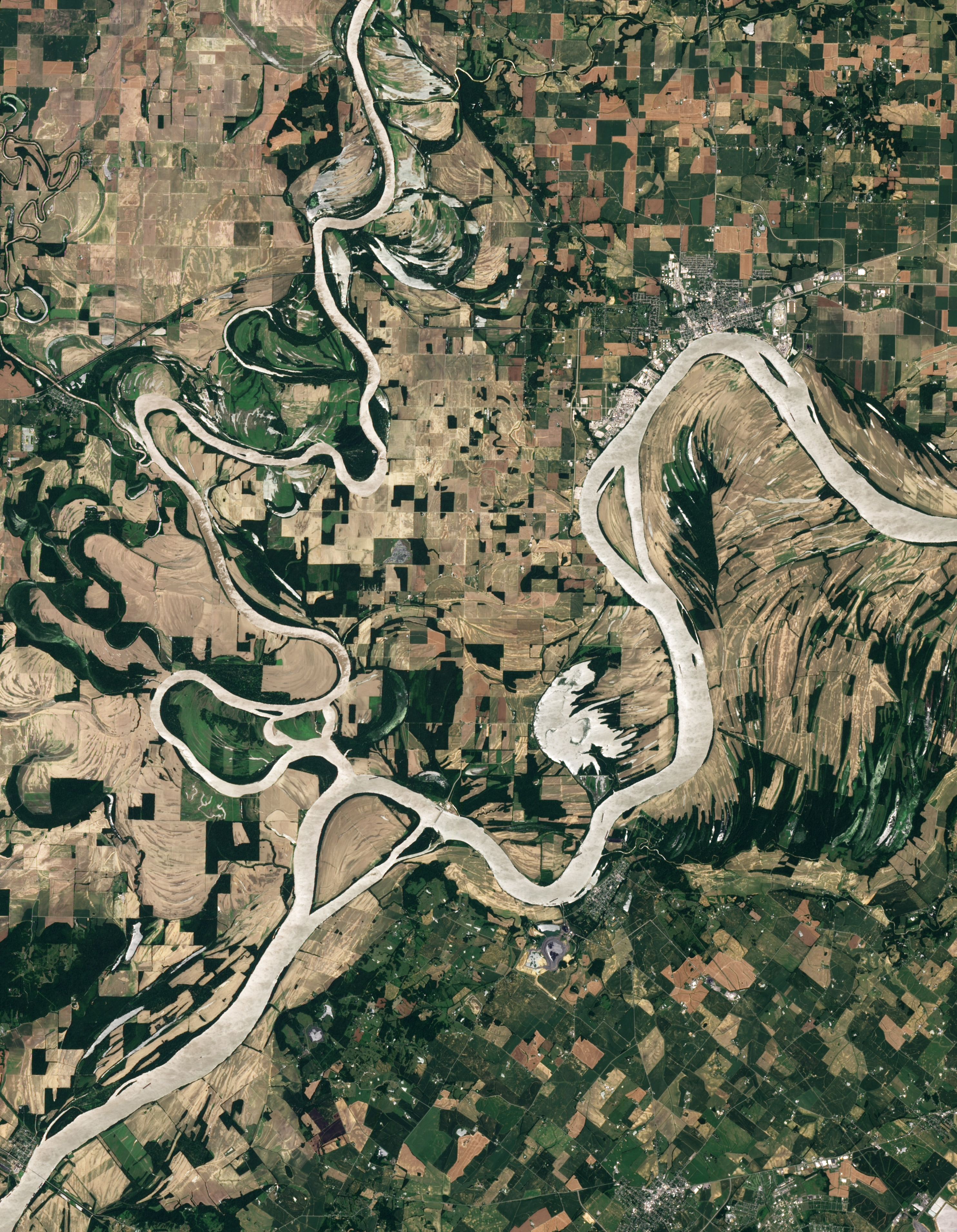
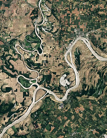
Afrikaans: Beeld in natuurlike kleur van die Wabash-Ohio-samevloeiing. Albei riviere, sowel as die Hoveymeer, vertoon silwergrys in hierdie beeld, waarskynlik weens die weerkaatsing van sonlig op die wateroppervlak. Op hoër grond lewer landboubedrywighede 'n lappieskombers van saailande, en in die waaie van die rivierkrommings is onbewerkte vloedvlaktes wat oorlopende riviere uitgelewer is.
English: Natural-colour image of the Wabash-Ohio confluence. Both rivers, as well as Hovey Lake, appear silver-grey in this image, probably due to the reflection of sunlight off the water surface (sunglint). Away from the water, the land is a patchwork of croplands shaped by human design, and floodplains shaped by overflowing rivers. |
| Data | |
| Fonte | NASA Earth Observatory |
| Autore | Robert Simmon |
Image captured by the Advanced Land Imager (ALI) on NASA’s Earth Observing-1 (EO-1) satellite. EO-1 ALI data provided courtesy of the NASA EO-1 team.
Licenza
| Questo file è nel pubblico dominio perché creato dalla NASA. La politica sul copyright della NASA afferma che «il materiale della NASA non è protetto da copyright a meno che non sia specificato altrimenti». (NASA copyright policy e JPL Image Use Policy). | ||
 |
Attenzione:
|
| Annotazioni | Questa immagine è annotata: Vedi le annotazioni su Commons |
Cronologia del file
Fare clic su un gruppo data/ora per vedere il file come si presentava nel momento indicato.
| Data/Ora | Miniatura | Dimensioni | Utente | Commento | |
|---|---|---|---|---|---|
| attuale | 20:35, 4 lug 2011 | | 2 968 × 3 821 (3,38 MB) | Originalwana | {{Information |Description ={{en|1=Natural-colour image of the Wabash-Ohio confluence. Both rivers, as well as Hovey Lake, appear silver-grey in this image, probably due to the reflection of sunlight off the water surface |
Pagine che usano questo file
La seguente pagina usa questo file:
Utilizzo globale del file
Anche i seguenti wiki usano questo file:
- Usato nelle seguenti pagine di ast.wikipedia.org:
- Usato nelle seguenti pagine di en.wikipedia.org:
- Usato nelle seguenti pagine di es.wikipedia.org:
- Usato nelle seguenti pagine di fa.wikipedia.org:
- Usato nelle seguenti pagine di fi.wikipedia.org:
- Usato nelle seguenti pagine di fy.wikipedia.org:
- Usato nelle seguenti pagine di ja.wikipedia.org:
- Usato nelle seguenti pagine di ta.wikipedia.org: