File:West Virginia Congressional Districts, 113th Congress.tif
Vai alla navigazione
Vai alla ricerca

Dimensioni di questa anteprima PNG per questo file TIF: 713 × 599 pixel. Altre risoluzioni: 286 × 240 pixel | 571 × 480 pixel | 914 × 768 pixel | 1 219 × 1 024 pixel | 1 347 × 1 132 pixel.
File originale (1 347 × 1 132 pixel, dimensione del file: 404 KB, tipo MIME: image/tiff)
| Questo file e la sua pagina di descrizione (discussione · modifica) si trovano su Wikimedia Commons (?) |
Dettagli
| Descrizione |
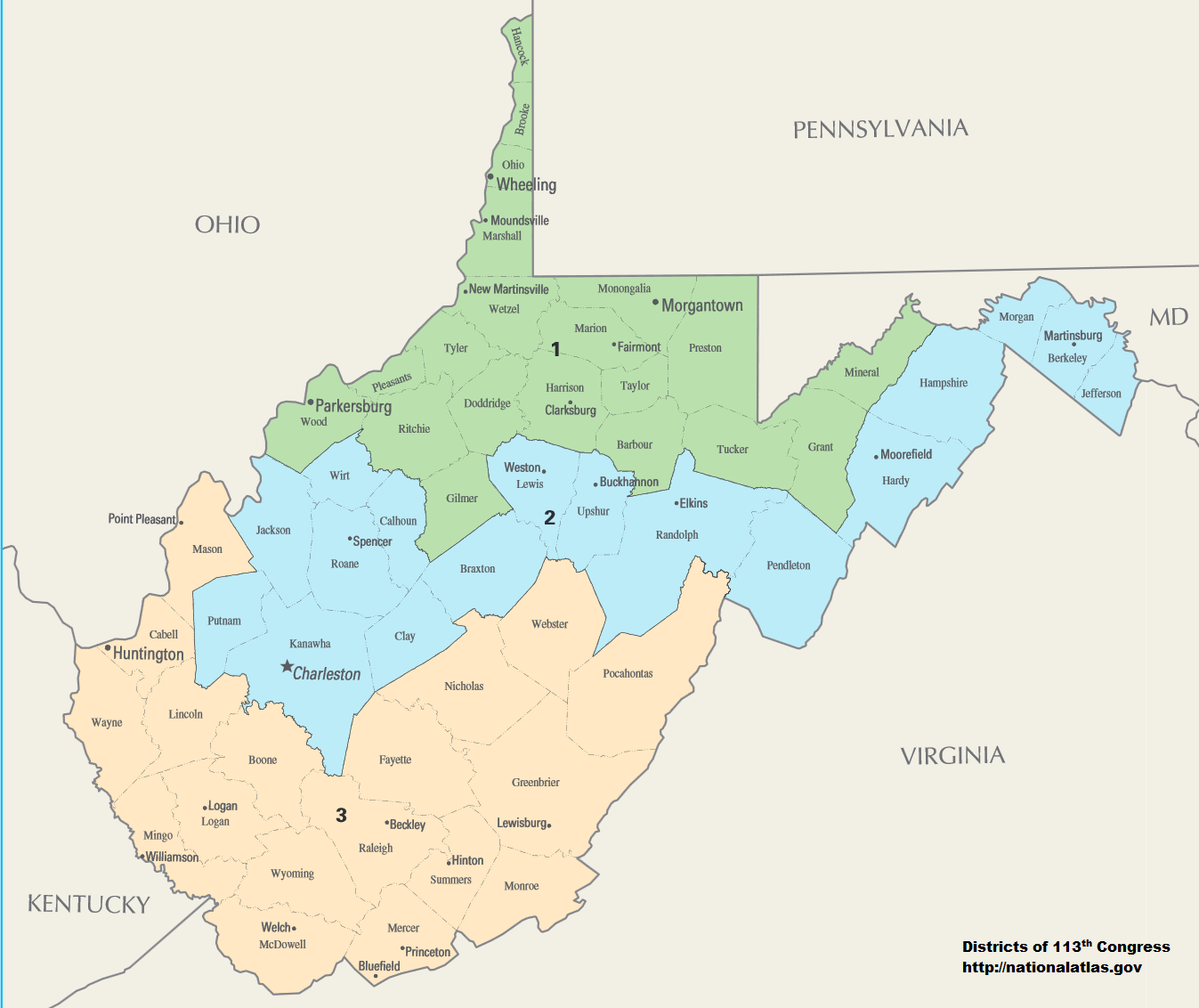
English: Map of Congressional Districts in the state of West Virginia, reflecting district boundaries current to the 113th United States Congress. |
| Data | |
| Fonte | National Atlas of the United States (http://nationalatlas.gov/printable/congress.html) |
| Autore | Department of the Interior |
| Licenza (Riusare questo file) |
This image is free information provided by the department of the interior. It was downloaded from http://nationalatlas.gov/printable/congress.html. All of that information has been provided in the captions, I'm not sure what other information is required. --7partparadigm talk 02:35, 8 February 2014 (UTC) |
Licenza
| This image or media file contains material based on a work of a United States Department of the Interior employee, created as part of that person's official duties. As a work of the U.S. federal government, such work is in the public domain in the United States. See the Department of the Interior copyright policy for more information. |  |
Cronologia del file
Fare clic su un gruppo data/ora per vedere il file come si presentava nel momento indicato.
| Data/Ora | Miniatura | Dimensioni | Utente | Commento | |
|---|---|---|---|---|---|
| attuale | 08:01, 2 feb 2014 |  | 1 347 × 1 132 (404 KB) | 7partparadigm | User created page with UploadWizard |
Pagine che usano questo file
Nessuna pagina utilizza questo file.
Utilizzo globale del file
Anche i seguenti wiki usano questo file:
- Usato nelle seguenti pagine di fa.wikipedia.org:
- Usato nelle seguenti pagine di ru.wikipedia.org:
- Usato nelle seguenti pagine di uk.wikipedia.org:
- Usato nelle seguenti pagine di zh.wikipedia.org: