File:Stroma OS map.png
Vai alla navigazione
Vai alla ricerca
Dimensioni di questa anteprima: 454 × 599 pixel. Altre risoluzioni: 182 × 240 pixel | 363 × 480 pixel | 582 × 768 pixel | 1 174 × 1 550 pixel.
File originale (1 174 × 1 550 pixel, dimensione del file: 151 KB, tipo MIME: image/png)
| Questo file e la sua pagina di descrizione (discussione · modifica) si trovano su Wikimedia Commons (?) |
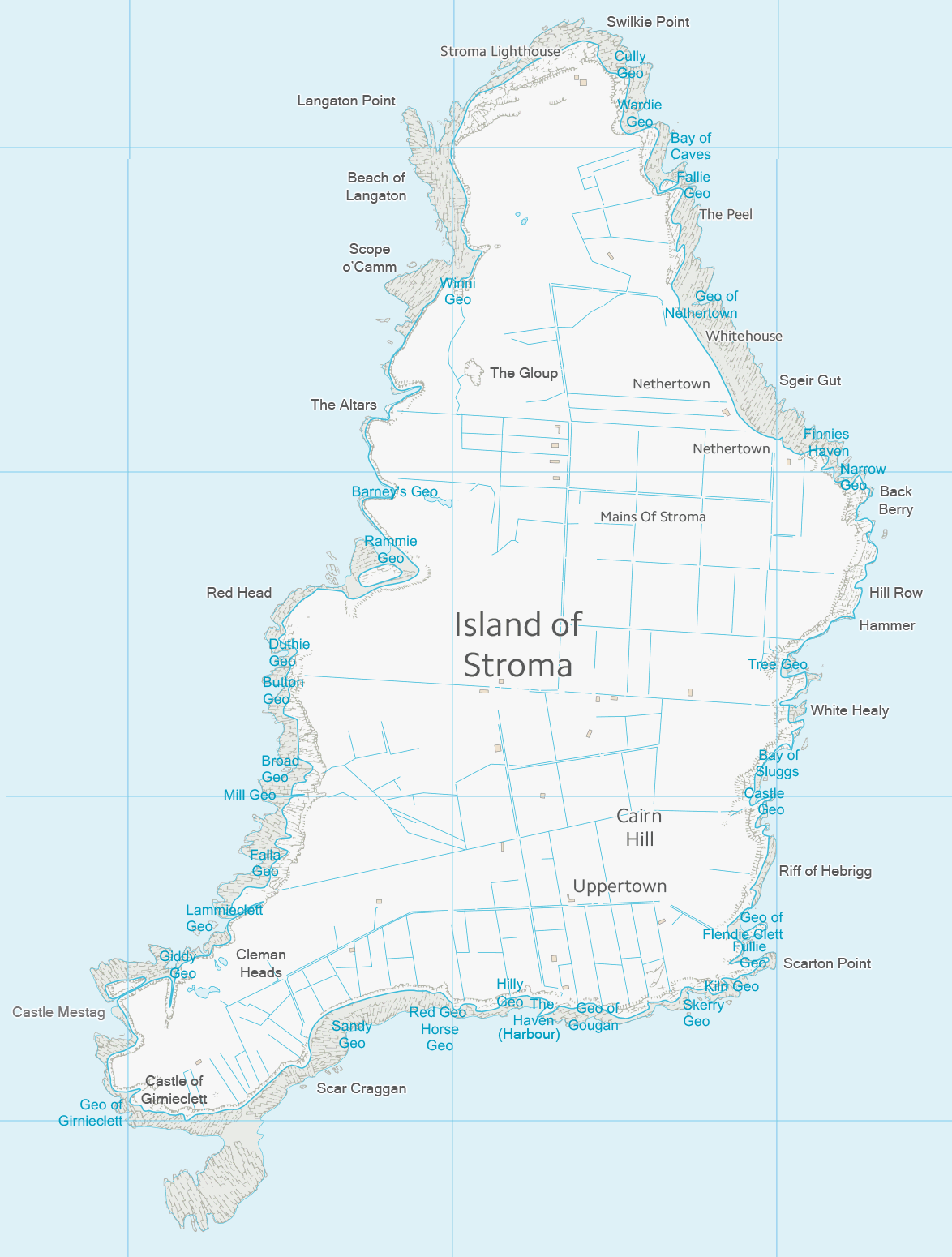
| Descrizione | Map of Stroma, Scotland | ||||||
| Data | |||||||
| Fonte | Ordnance Survey OpenData with additional placenames added by uploader | ||||||
| Autore | Ordnance Survey | ||||||
| Licenza (Riusare questo file) |
|
_(St_Edwards_Crown).svg)

|
Questa immagine (categorizzazione automatica: map) o tutte le immagini in questa categoria o galleria dovrebbero essere ricreate usando grafica vettoriale come file SVG. Questo offre diversi vantaggi: vedi Commons:Media for cleanup per maggiori informazioni. Se è disponibile una versione in formato SVG di questa immagine, per favore caricala. Dopo aver caricato un file SVG, sostituisci questo avviso con il template {{Vector version available|nome_immagine.svg}}.
|
Cronologia del file
Fare clic su un gruppo data/ora per vedere il file come si presentava nel momento indicato.
| Data/Ora | Miniatura | Dimensioni | Utente | Commento | |
|---|---|---|---|---|---|
| attuale | 02:02, 31 ott 2013 | | 1 174 × 1 550 (151 KB) | Prioryman | |
| 02:01, 31 ott 2013 |  | 1 174 × 1 550 (151 KB) | Prioryman | {{Information |Description=Map of Stroma, Scotland |Source=Ordnance Survey OpenData with additions by uploader |Date=31 October 2013 |Author=Ordnance Survey |Permission={{OS OpenData}} |other_versions= }} Category:Stroma |
Pagine che usano questo file
La seguente pagina usa questo file:
Utilizzo globale del file
Anche i seguenti wiki usano questo file:
- Usato nelle seguenti pagine di de.wikipedia.org:
- Usato nelle seguenti pagine di en.wikipedia.org:
- Usato nelle seguenti pagine di simple.wikipedia.org: