File:Ph locator map palawan.png
Vai alla navigazione
Vai alla ricerca
Non sono disponibili versioni a risoluzione più elevata.
Ph_locator_map_palawan.png (300 × 440 pixel, dimensione del file: 26 KB, tipo MIME: image/png)
| Questo file e la sua pagina di descrizione (discussione · modifica) si trovano su Wikimedia Commons (?) |
Dettagli
| Descrizione |
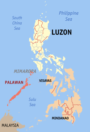
English: Map of the Philippines showing the location of Palawan. Red shade: Palawan Province; Light shade: Luzon Island Group; Orange: Rest of the Philippines |
| Data | |
| Fonte | English Wikipedia |
| Autore | Eugene Alvin Villar (seav) |
Licenza

|
È permesso copiare, distribuire e/o modificare questo documento in base ai termini della GNU Free Documentation License, Versione 1.2 o successive pubblicata dalla Free Software Foundation; senza alcuna sezione non modificabile, senza testo di copertina e senza testo di quarta di copertina. Una copia della licenza è inclusa nella sezione intitolata Testo della GNU Free Documentation License. |
| Questo file è disponibile in base alla licenza Creative Commons Attribuzione-Condividi allo stesso modo 3.0 Unported | ||
| ||
| Questo tag di copyright è stato aggiunto nell'ambito dell'aggiornamento della licenza dei progetti Wikimedia. |

|
If you choose to use this work under the Creative Commons license stated on this page, the author, Eugene Alvin Villar (seav), would like you to attribute the work to him (among other requirements such as indicating that the work is licensed under the Creative Commons) with the following text or similar:
© Eugene Alvin Villar, 2003
His name should be a link to his Wikimedia Commons userpage. If a link is not possible, then the url should be placed in parentheses after the name. If the work has been substantially altered by other people (see the File history section below), then this particular attribution requirement is waived, which means you can attribute the work in any reasonable manner. This attribution requirement is provided pursuant to the Creative Commons Attribution mechanism where "you must attribute the work in the manner specified by the author or licensor (but not in any way that suggests that they endorse you or your use of the work)." (See "Attribution" in the Creative Commons website.)
|
Cronologia del file
Fare clic su un gruppo data/ora per vedere il file come si presentava nel momento indicato.
| Data/Ora | Miniatura | Dimensioni | Utente | Commento | |
|---|---|---|---|---|---|
| attuale | 15:28, 1 lug 2009 | | 300 × 440 (26 KB) | Hariboneagle927 | Palawan is in the MIMAROPA region references: http://en.wikipedia.org/wiki/MIMAROPA |
| 15:53, 30 dic 2005 |  | 300 × 440 (19 KB) | Magalhães | Map of the Philippines showing the location of Palawan. Created and copyright (2003) by seav. Released under the GNU FDL. | |
| 22:45, 18 ago 2005 |  | 300 × 450 (15 KB) | Gildemax | Map of the Philippines showing the location of Palawan. Map of the Philippines showing the location of Palawan. Created and copyright (2003) by [[:en:user:]seav]]Released under the GNU FDL. Source: http://en.wikipedia.org/wiki/Image:Ph_locator_map_pal |
Pagine che usano questo file
Nessuna pagina utilizza questo file.
Utilizzo globale del file
Anche i seguenti wiki usano questo file:
- Usato nelle seguenti pagine di nl.wikipedia.org: