File:Diehls Covered Bridge.jpg
Vai alla navigazione
Vai alla ricerca
Dimensioni di questa anteprima: 800 × 549 pixel. Altre risoluzioni: 320 × 220 pixel | 640 × 439 pixel | 1 024 × 703 pixel | 1 280 × 879 pixel | 2 560 × 1 758 pixel | 4 772 × 3 277 pixel.
File originale (4 772 × 3 277 pixel, dimensione del file: 1,67 MB, tipo MIME: image/jpeg)
| Questo file e la sua pagina di descrizione (discussione · modifica) si trovano su Wikimedia Commons (?) |
|
Questa è un'immagine di un luogo o edificio che è elencato nel National Register of Historic Places negli Stati Uniti. Il suo numero di riferimento è [https://npgallery.nps.gov/AssetDetail/NRIS/80003420
. 80003420
.]. |
| Luogo dello scatto | | Posizione di questa e altre immagini su: OpenStreetMap |
|---|
| Descrizione |
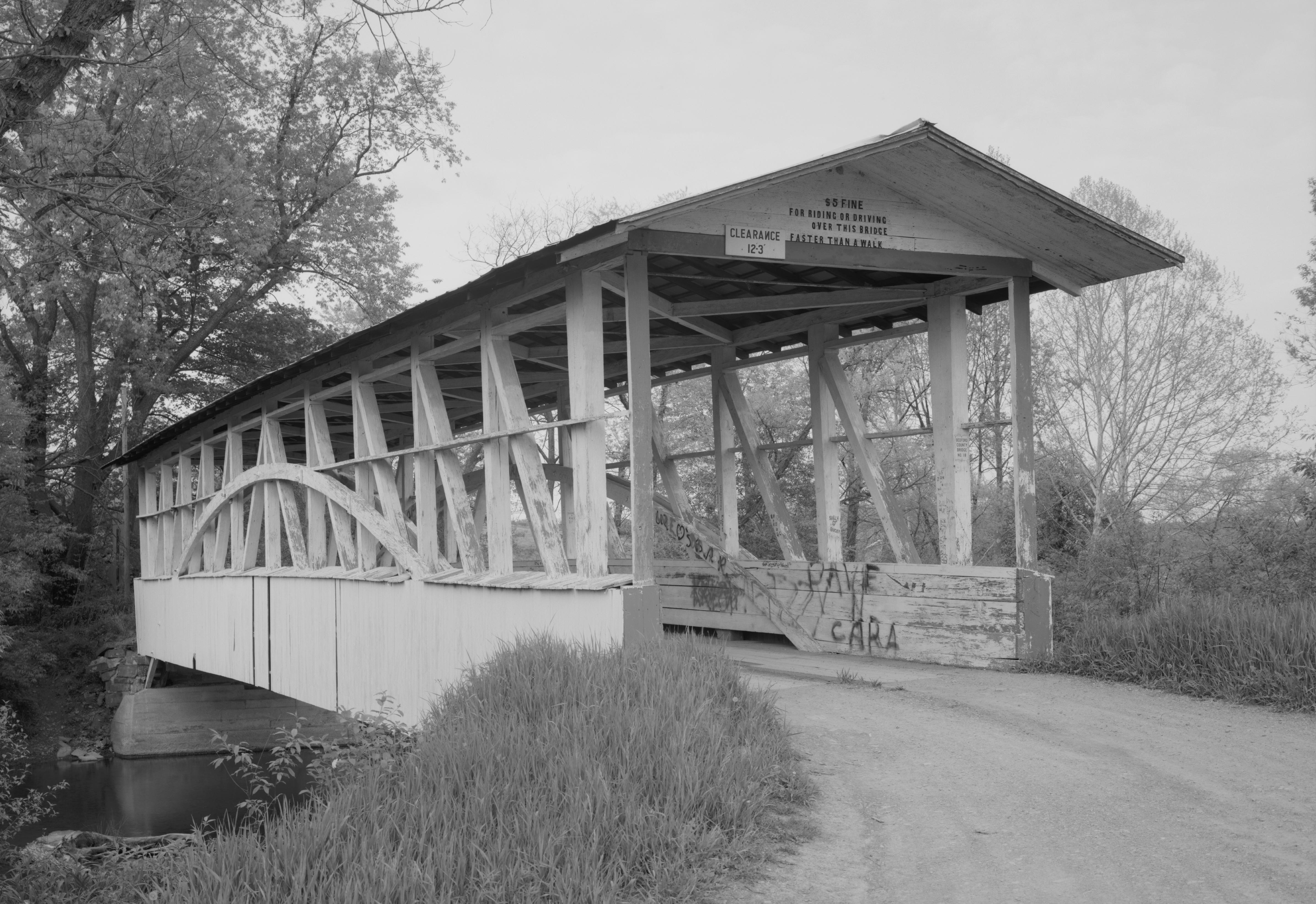
English: Southern end of the Diehls Covered Bridge, which carries Township Route 418 over the Raystown Branch of the Juniata River south of Schellsburg in Harrison and Napier Townships of Bedford County, Pennsylvania, United States. Built in 1892, this Burr arch truss bridge is listed on the National Register of Historic Places. |
|||||||||||||||||||||||
| Data | ||||||||||||||||||||||||
| Fonte | Library of Congress, Prints and Photograph Division HAER: PA,5-MANCH.V,1-1 | |||||||||||||||||||||||
| Autore |
|
|||||||||||||||||||||||
| Licenza (Riusare questo file) |
|
|||||||||||||||||||||||
.jpg)

|
Questa image è disponibile presso la Divisione Stampe e Fotografie (Prints and Photographs Division) della Biblioteca del Congresso sotto l'ID digitale hhh.pa3207.
Questo tag non indica lo status del copyright dell'opera ad esso associato. È quindi richiesto un normale tag di copyright. Vedi Commons:Licenze per maggiori informazioni.
|
Cronologia del file
Fare clic su un gruppo data/ora per vedere il file come si presentava nel momento indicato.
| Data/Ora | Miniatura | Dimensioni | Utente | Commento | |
|---|---|---|---|---|---|
| attuale | 15:51, 21 dic 2009 | | 4 772 × 3 277 (1,67 MB) | Nyttend | {{Location|40|0|34|N|78|38|55|W}} {{Information |Description={{en|Southern end of the {{w|Diehls Covered Bridge}}, which carries Township Route 418 over the {{w|Raystown Branch Juniata River|Raystown Branch}} of the {{w|Juniata River}} south of {{w|Schell |
Pagine che usano questo file
La seguente pagina usa questo file:
Utilizzo globale del file
Anche i seguenti wiki usano questo file:
- Usato nelle seguenti pagine di ca.wikipedia.org:
- Usato nelle seguenti pagine di en.wikipedia.org:
- Usato nelle seguenti pagine di es.wikipedia.org:
- Usato nelle seguenti pagine di fr.wikipedia.org:
- Usato nelle seguenti pagine di ha.wikipedia.org:
- Usato nelle seguenti pagine di tl.wikipedia.org:
- Usato nelle seguenti pagine di uk.wikipedia.org:
- Usato nelle seguenti pagine di ur.wikipedia.org:
- Usato nelle seguenti pagine di vi.wikipedia.org:
- Usato nelle seguenti pagine di www.wikidata.org: