File:Salt-River-Bay-2.jpg
Vai alla navigazione
Vai alla ricerca
Dimensioni di questa anteprima: 800 × 457 pixel. Altre risoluzioni: 320 × 183 pixel | 640 × 366 pixel | 1 024 × 585 pixel | 1 400 × 800 pixel.
File originale (1 400 × 800 pixel, dimensione del file: 302 KB, tipo MIME: image/jpeg)
| Questo file e la sua pagina di descrizione (discussione · modifica) si trovano su Wikimedia Commons (?) |
Dettagli
| Descrizione |
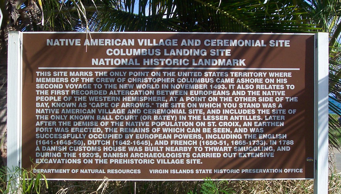
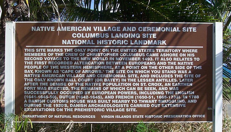
Historical marker/information sign at Salt River Bay National Historical Park and Ecological Preserve. 17°46′44″N 64°45′33″W / 17.77889°N 64.75917°W Transcription:
|
| Data | |
| Fonte | Opera propria |
| Autore | self |
| Licenza (Riusare questo file) |
public domain |
Licenza
| Io, detentore del copyright su quest'opera, la rilascio nel pubblico dominio. Questa norma si applica in tutto il mondo. In alcuni paesi questo potrebbe non essere legalmente possibile. In tal caso: Garantisco a chiunque il diritto di utilizzare quest'opera per qualsiasi scopo, senza alcuna condizione, a meno che tali condizioni siano richieste dalla legge. |
Cronologia del file
Fare clic su un gruppo data/ora per vedere il file come si presentava nel momento indicato.
| Data/Ora | Miniatura | Dimensioni | Utente | Commento | |
|---|---|---|---|---|---|
| attuale | 20:26, 7 mar 2007 | | 1 400 × 800 (302 KB) | Eoghanacht | {{Information |Description= Historical marker/information sign at {{w|Salt River Bay National Historical Park and Ecological Preserve}}. {{coor dms|17|46|44|N|64|45|33|W|}} |Source= own work |Date= 2007 February |Author= self |Permission= public domain | |
Pagine che usano questo file
La seguente pagina usa questo file:
Utilizzo globale del file
Anche i seguenti wiki usano questo file:
- Usato nelle seguenti pagine di en.wikipedia.org:
- Usato nelle seguenti pagine di sr.wikipedia.org:
- Usato nelle seguenti pagine di vi.wikipedia.org: