File:Elkader Keystone Bridge.jpg
Vai alla navigazione
Vai alla ricerca
Dimensioni di questa anteprima: 768 × 599 pixel. Altre risoluzioni: 308 × 240 pixel | 615 × 480 pixel | 984 × 768 pixel | 1 280 × 999 pixel | 2 560 × 1 998 pixel | 4 343 × 3 389 pixel.
File originale (4 343 × 3 389 pixel, dimensione del file: 1,3 MB, tipo MIME: image/jpeg)
| Questo file e la sua pagina di descrizione (discussione · modifica) si trovano su Wikimedia Commons (?) |
|
Questa è un'immagine di un luogo o edificio che è elencato nel National Register of Historic Places negli Stati Uniti. Il suo numero di riferimento è [https://npgallery.nps.gov/AssetDetail/NRIS/76000747
. 76000747
.]. |
| Luogo dello scatto | | Posizione di questa e altre immagini su: OpenStreetMap |
|---|
| Descrizione |
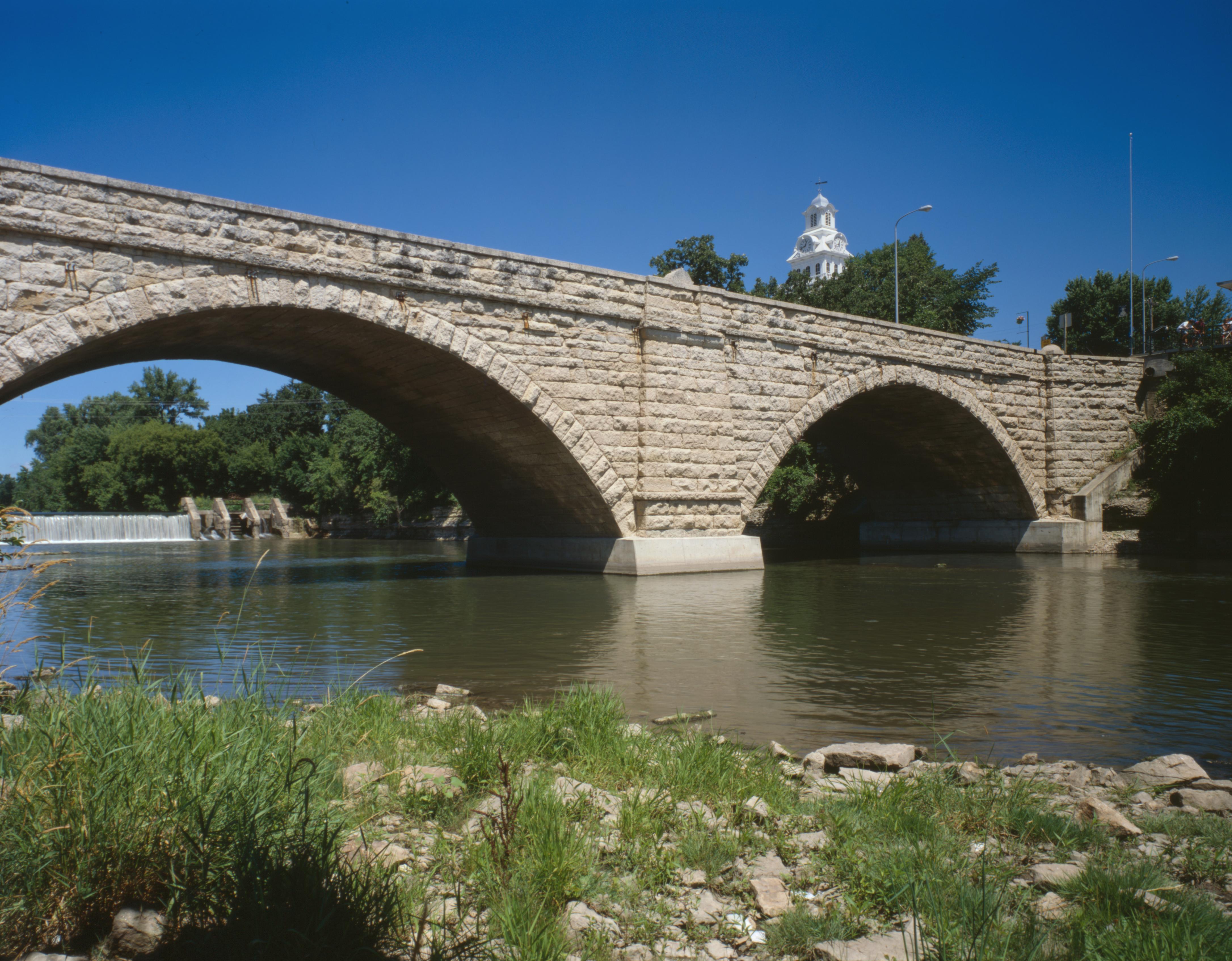
English: Southern (downsteam) side of the Elkader Keystone Bridge, which carries Bridge Street over the Turkey River at Elkader, Iowa, United States. Built in 1888, it is listed on the National Register of Historic Places. Note the tower of the Clayton County Courthouse, also Register-listed, in the background. |
||||
| Data | estate 1995 | ||||
| Fonte | Library of Congress, Prints and Photograph Division HAER: IA-47-9 | ||||
| Autore | Joseph Elliott | ||||
| Licenza (Riusare questo file) |
|

|
Questa image è disponibile presso la Divisione Stampe e Fotografie (Prints and Photographs Division) della Biblioteca del Congresso sotto l'ID digitale hhh.ia0423.
Questo tag non indica lo status del copyright dell'opera ad esso associato. È quindi richiesto un normale tag di copyright. Vedi Commons:Licenze per maggiori informazioni.
|
Cronologia del file
Fare clic su un gruppo data/ora per vedere il file come si presentava nel momento indicato.
| Data/Ora | Miniatura | Dimensioni | Utente | Commento | |
|---|---|---|---|---|---|
| attuale | 23:53, 31 mag 2009 | | 4 343 × 3 389 (1,3 MB) | Cropbot | upload cropped version, operated by User:Finavon. Summary: border cropped |
| 13:32, 30 mag 2009 |  | 4 706 × 3 765 (1,49 MB) | Nyttend | {{Location|42|51|17|N|91|24|13|W}} {{Information |Description={{en|Southern (downsteam) side of the {{w|Elkader Keystone Bridge}}, which carries Bridge Street over the {{w|Turkey River (Iowa)|Turkey River}} at {{w|Elkader, Iowa|Elkader}}, {{w|Iowa}}, {{w| |
Pagine che usano questo file
La seguente pagina usa questo file:
Utilizzo globale del file
Anche i seguenti wiki usano questo file:
- Usato nelle seguenti pagine di ar.wikipedia.org:
- Usato nelle seguenti pagine di arz.wikipedia.org:
- Usato nelle seguenti pagine di bn.wikipedia.org:
- Usato nelle seguenti pagine di de.wikipedia.org:
- Usato nelle seguenti pagine di en.wikipedia.org:
- Usato nelle seguenti pagine di eo.wikipedia.org:
- Usato nelle seguenti pagine di es.wikipedia.org:
- Usato nelle seguenti pagine di fr.wikipedia.org:
- Usato nelle seguenti pagine di pt.wikipedia.org:
- Usato nelle seguenti pagine di www.wikidata.org: