File:Wind Turbines and Power Lines, East Sussex, England - April 2009.jpg
Vai alla navigazione
Vai alla ricerca

Dimensioni di questa anteprima: 800 × 386 pixel. Altre risoluzioni: 320 × 155 pixel | 640 × 309 pixel | 1 024 × 494 pixel | 1 280 × 618 pixel | 2 560 × 1 236 pixel | 8 190 × 3 955 pixel.
File originale (8 190 × 3 955 pixel, dimensione del file: 7,67 MB, tipo MIME: image/jpeg)
| Questo file e la sua pagina di descrizione (discussione · modifica) si trovano su Wikimedia Commons (?) |
Dettagli
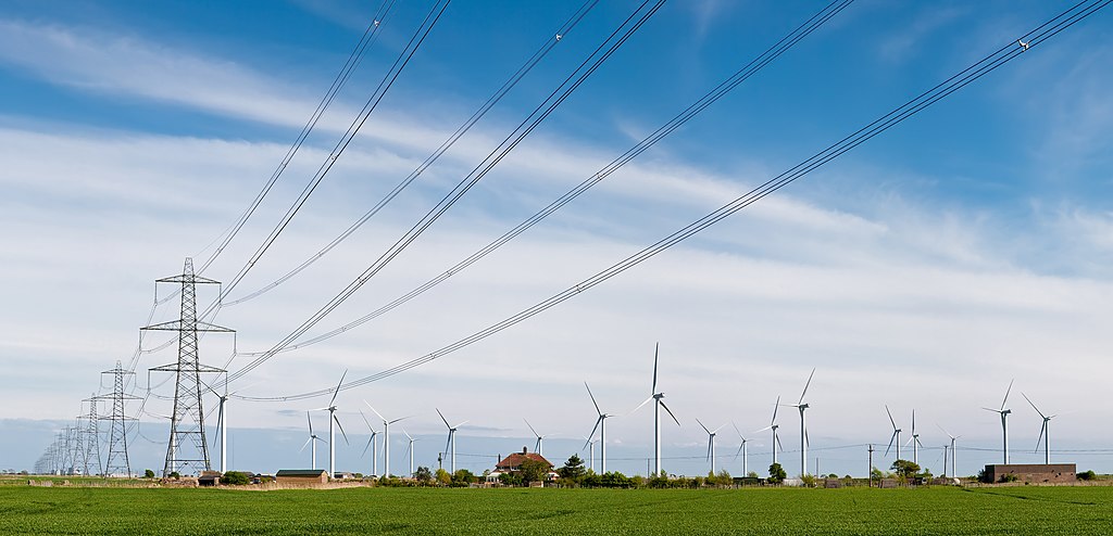
| Descrizione |
English: A windfarm and electricity pylons/power lines near Rye, East Sussex, England. The 400 kV power lines are from Dungeness Nuclear Power Station, which is just visible on the skyline behind the pylons.
Français : Un champs d'éoliennes et des pylônes électriques de Lignes à haute tension (400 kV) près de Rye dans le Sussex de l'Est, en Angleterre.
Deutsch: Eine 400-kV-Freileitungstrasse vor einem Windpark nahe Rye, Süd Sussex, England. Die Stromleitung führt zur Dungeness Nuclear Power Station, die auch klein am Horizont zu erkennen ist. |
| Data | prima del 27 aprile 2009 |
| Fonte | Opera propria |
| Autore | Diliff |
| Licenza (Riusare questo file) |
Summary:In using this image or any subsequent derivatives of it, you are required to release the image under the same license. As such, any reproduction of this image, in any medium, must appear with a copy of, or full URL of the license.Attribution of this image to the author (DAVID ILIFF) is also required, preferably in a prominent location near the image.No other conditions may be added to, or removed from this license without the permission of the author and copyright holder.Suggested attribution: "Photo by DAVID ILIFF. License: CC BY-SA 3.0"Please review the full license requirements carefully before using this image. If you would like to clarify the terms of the license or negotiate less restrictive commercial licensing outside of the bounds of GFDL/CC-BY-SA, please contact me by email, or if you don't have a Wikipedia account you can either leave a message on my talk page with your contact details and your request, or you can contact me on Facebook. Please also send a 'friend request' to ensure that I am aware of your message. |
| Luogo dello scatto | | Posizione di questa e altre immagini su: OpenStreetMap |
|---|
Licenza
Io, detentore del copyright su quest'opera, dichiaro di pubblicarla con le seguenti licenze:
Questo file è disponibile in base alla licenza Creative Commons Attribuzione-Condividi allo stesso modo 3.0 Unported
- Tu sei libero:
- di condividere – di copiare, distribuire e trasmettere quest'opera
- di modificare – di adattare l'opera
- Alle seguenti condizioni:
- attribuzione – Devi fornire i crediti appropriati, un collegamento alla licenza e indicare se sono state apportate modifiche. Puoi farlo in qualsiasi modo ragionevole, ma non in alcun modo che suggerisca che il licenziante approvi te o il tuo uso.
- condividi allo stesso modo – Se remixi, trasformi o sviluppi il materiale, devi distribuire i tuoi contributi in base alla stessa licenza o compatibile all'originale.

|
È permesso copiare, distribuire e/o modificare questo documento in base ai termini della GNU Free Documentation License, Versione 1.2 o successive pubblicata dalla Free Software Foundation; senza alcuna sezione non modificabile, senza testo di copertina e senza testo di quarta di copertina. Una copia della licenza è inclusa nella sezione intitolata Testo della GNU Free Documentation License. |
Puoi scegliere la licenza che preferisci.
|

Questa immagine è stata valutata utilizzando le linee guida sulla qualità delle immagini ed è considerata una immagine di qualità.
|
Cronologia del file
Fare clic su un gruppo data/ora per vedere il file come si presentava nel momento indicato.
| Data/Ora | Miniatura | Dimensioni | Utente | Commento | |
|---|---|---|---|---|---|
| attuale | 23:15, 26 apr 2009 | | 8 190 × 3 955 (7,67 MB) | Diliff | {{Information |Description={{en|1=A windfarm and electricity pylons/power lines near Rye, East Sussex, England.}} |Source=Own work by uploader |Author=Diliff |Date= |Permission={{Diliff/Licensing}} |other_versions= }} {{location dec|50.975 |
Pagine che usano questo file
Nessuna pagina utilizza questo file.
Utilizzo globale del file
Anche i seguenti wiki usano questo file:
- Usato nelle seguenti pagine di de.wikipedia.org:
- Usato nelle seguenti pagine di de.wikiversity.org:
- Usato nelle seguenti pagine di en.wikipedia.org:
- Usato nelle seguenti pagine di fr.wikipedia.org:
- Usato nelle seguenti pagine di hr.wikipedia.org:
- Usato nelle seguenti pagine di pl.wikipedia.org:
- Usato nelle seguenti pagine di ru.wikipedia.org:
- Usato nelle seguenti pagine di su.wikipedia.org:
- Usato nelle seguenti pagine di vi.wikipedia.org: