File:Connacht locator map.svg
Vai alla navigazione
Vai alla ricerca

Dimensioni di questa anteprima PNG per questo file SVG: 459 × 599 pixel. Altre risoluzioni: 184 × 240 pixel | 368 × 480 pixel | 589 × 768 pixel | 785 × 1 024 pixel | 1 570 × 2 048 pixel | 1 264 × 1 649 pixel.
File originale (file in formato SVG, dimensioni nominali 1 264 × 1 649 pixel, dimensione del file: 593 KB)
| Questo file e la sua pagina di descrizione (discussione · modifica) si trovano su Wikimedia Commons (?) |
Dettagli
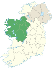
| Descrizione | Locator map of Connacht. |
| Data | (UTC) |
| Fonte | |
| Autore |
|
Licenza
Io, detentore del copyright su quest'opera, dichiaro di pubblicarla con la seguente licenza:
Questo file è disponibile in base alla licenza Creative Commons Attribuzione-Condividi allo stesso modo 3.0 Unported
- Tu sei libero:
- di condividere – di copiare, distribuire e trasmettere quest'opera
- di modificare – di adattare l'opera
- Alle seguenti condizioni:
- attribuzione – Devi fornire i crediti appropriati, un collegamento alla licenza e indicare se sono state apportate modifiche. Puoi farlo in qualsiasi modo ragionevole, ma non in alcun modo che suggerisca che il licenziante approvi te o il tuo uso.
- condividi allo stesso modo – Se remixi, trasformi o sviluppi il materiale, devi distribuire i tuoi contributi in base alla stessa licenza o compatibile all'originale.
Cronologia del file
Fare clic su un gruppo data/ora per vedere il file come si presentava nel momento indicato.
| Data/Ora | Miniatura | Dimensioni | Utente | Commento | |
|---|---|---|---|---|---|
| attuale | 16:18, 8 giu 2013 | | 1 264 × 1 649 (593 KB) | Setanta Saki | Including Aran Islands are part of province of Connacht |
| 21:50, 7 gen 2012 |  | 1 450 × 1 807 (687 KB) | NikNaks | Fix | |
| 21:47, 7 gen 2012 |  | 1 450 × 1 807 (687 KB) | NikNaks | Removing modern boundaries | |
| 20:20, 7 gen 2012 |  | 1 450 × 1 807 (708 KB) | NikNaks | Updating to new map | |
| 19:53, 7 gen 2012 |  | 400 × 500 (281 KB) | NikNaks93 | == {{int:filedesc}} == {{Information |Description=Locator map of Connacht. |Source=*File:Ireland_trad_counties_named.svg |Date=2012-01-07 17:50 (UTC) |Author=*File:Ireland_trad_counties_named.svg: *[[:File:Population_density_of_Ireland_map2002 |
Pagine che usano questo file
La seguente pagina usa questo file:
Utilizzo globale del file
Anche i seguenti wiki usano questo file:
- Usato nelle seguenti pagine di ar.wikipedia.org:
- Usato nelle seguenti pagine di ca.wikipedia.org:
- Usato nelle seguenti pagine di cs.wikipedia.org:
- Usato nelle seguenti pagine di da.wikipedia.org:
- Usato nelle seguenti pagine di en.wikipedia.org:
- Achill Island
- Connacht
- Croagh Patrick
- List of Ireland-related topics
- Twelve Bens
- Lists of mountains in Ireland
- Devilsmother
- Leenaun
- Knocknarea
- Mweelrea
- Nephin
- Dartry Mountains
- Benbaun
- Benbulbin
- Slievemore
- Curlew Mountains
- Barrclashcame
- Croaghaun
- Slieve Carr
- Binn idir an dá Log
- Ben Gorm
- Maumtrasna
- Ox Mountains
- Partry Mountains
- Errisbeg
- Nephin Beg
- Nephin Beg Range
- List of Irish counties by highest point
- Truskmore
- Knockalongy
- Template:Mountains and hills of Connacht
- Sheeffry Hills
- Knockmore, Mayo
- Bencorr
- Knocknashee
- Truskmore SE Cairn
- List of mountains and hills of County Mayo
- Maumturks
- Birreencorragh
- Slieve Bawn
- Corcogemore
- Lackavrea
- Letterbreckaun
- Binn Mhór
- Binn Chaonaigh
- Garraun (Galway)
Visualizza l'utilizzo globale di questo file.