File proveniente da Wikimedia Commons. Clicca per visitare la pagina originale

File:St Helens island Scilly.svg

Da Wikipedia, l'enciclopedia libera.
Vai alla navigazione Vai alla ricerca

File originale(file in formato SVG, dimensioni nominali 919 × 919 pixel, dimensione del file: 175 KB)

Logo di Commons
Logo di Commons
Questo file e la sua pagina di descrizione (discussione · modifica) si trovano su Wikimedia Commons (?)
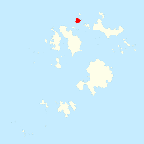
Descrizione St Helen's, in the Isles of Scilly
Data
Fonte Ordnance Survey OpenData, Boundary-Line product
Autore Ordnance Survey
Licenza
(Riusare questo file)
This file is licensed by the Ordnance Survey of the United Kingdom under their OS OpenData License
In short: you are free to distribute and modify the file as long as you attribute (including year), the Ordnance Survey.
Attribuzione: Contains Ordnance Survey data © Crown copyright and database right (year)
Note: Derivative works can be licensed under any Creative Commons Attribution 3.0 Licence.
This file is licensed under the United Kingdom Open Government Licence v3.0.
You are free to:
  • copy, publish, distribute and transmit the Information;
  • adapt the Information;
  • exploit the Information commercially and non-commercially for example, by combining it with other Information, or by including it in your own product or application.
You must, where you do any of the above:
  • acknowledge the source of the Information in your product or application by including or linking to any attribution statement specified by the Information Provider(s) and, where possible, provide a link to this licence;
  • If the Information Provider does not provide a specific attribution statement, you must use the following:
Contains public sector information licensed under the Open Government Licence v3.0.
This licence does NOT cover:
  • personal data in the Information;
  • Information that has not been accessed by way of publication or disclosure under information access legislation (including the Freedom of Information Acts for the UK and Scotland) by or with the consent of the Information Provider;
  • departmental or public sector organisation logos, crests and the Royal Arms except where they form an integral part of a document or dataset;
  • military insignia;
  • third party rights the Information Provider is not authorised to license;
  • other intellectual property rights, including patents, trade marks, and design rights; and
  • identity documents such as the British Passport.
Consult this guide for full details.
Note: Since 2010, almost all information owned by the UK Crown is offered for use and re-use under the Open Government Licence by authority of The Controller of His Majesty's Stationery Office.info
See also: Meta for information on usage on Wikimedia wikis.
Questa è una immagine ritoccata, il che significa che è stata modificata digitalmente dalla sua versione originale. Modifiche: Highlighted St Helen's. La versione originale può essere vista qui: Isles of Scilly UK locator map.svg. Le modifiche sono di Hogweard.

Didascalie

Aggiungi una brevissima spiegazione di ciò che questo file rappresenta

Elementi ritratti in questo file

raffigura

Cronologia del file

Fare clic su un gruppo data/ora per vedere il file come si presentava nel momento indicato.

Data/OraMiniaturaDimensioniUtenteCommento
attuale00:28, 29 feb 2012Miniatura della versione delle 00:28, 29 feb 2012919 × 919 (175 KB)Hogweard{{Information |Description=St Helen's, in the Isles of Scilly |Source=Ordnance Survey [https://www.ordnancesurvey.co.uk/opendatadownload/products.html OpenData], Boundary-Line product |Date=2010 |Author=Ordnance Survey |Permission={{OS OpenData}} |othe...

La seguente pagina usa questo file:

Utilizzo globale del file

Anche i seguenti wiki usano questo file: